PROJECT SedInOut
Detection of alpine slope movements with satellite-based InSAR
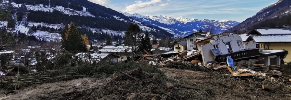
The European Alps are strongly affected by recent climate warming. Over the last 150 years temperatures in the Alps increased twice as much as the global mean causing increased heavy precipitation, dramatic glacier retreat and extensive permafrost thaw. Regional observations of increased mass wasting activity seem to confirm a growing climatic pressure on alpine slopes. Warming-induced destabilization therefore is of growing importance and represents a significant threat for alpine settlements and infrastructures.
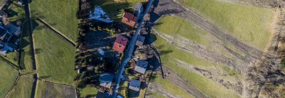
Landslides and debris flows are frequently preceded by continuous annual deformation in the centimeter range. However, due to the problematic detectability of small-scale slope movements little is known about their geographical distribution and their potential in indicating the spontaneous – and sometimes catastrophic – occurrence of natural hazards. The project ‘SedInOut’ targets the development of a methodology to detect and analyze small-scale slope movements in order to systematically assess mass movement risks on alpine slopes.
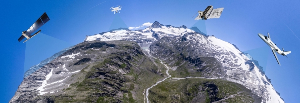
GEORESEARCH will investigate the applicability of various cutting-edge remote sensing technologies with a special focus on satellite-based interferometric synthetic aperture radar (InSAR). InSAR currently represents the only remote sensing technique capable of detecting slope movements (i) directly and precisely at millimeter accuracy, (ii) at various scales ranging from individual buildings to large areas, (iii) over long perennial time scales.
Based on InSAR records dating back to 2014 alpine slope movements will be detected and analyzed in the provinces of Salzburg, Carinthia and South Tyrol over an area of around 15.000 km². For an in-depth examination of the identified hot spots of slope movement, complementary data from ALS (Airborne Laserscanning) and UAS (Unmanned Aerial Systems) surveys will be used. The hazard potential of the identified hot spots will furthermore be verified during geological field investigations. In addition to hazard maps, formal guidelines for a structured risk evaluation of alpine slopes will be derived.
PROFILE
Contribution GEORESEARCH: Project partner
Projekt Partners: Geologischer Dienst Land Salzburg,
Amt der Kärntner Landesregierung - Abteilung 8,
Regione autonoma Friuli Venezia Giulia,
Provincia autonoma di Bolzano,
Regione del Veneto
Projekt Duration: 2019 - 2022
Funding: Interreg V-A Italien-Österreich
PROJECT PARTNERS
Geological Service Salzburg
Carinthian Provincial Government
Regione autonoma Friuli Venezia Giulia
Provincia autonoma di Bolzano
ORF Salzburg Heute

Yesterday’s edition of the ORF newscast ‘Salzburg Heute’ covered our research activities in the Hohe Tauern Range and addressed how recent climate warming increases debris flow and rockfall risks. The feature is available online until 18.07.2022 – check it out!
more details ...