Satellite-based detection and monitoring of high alpine mass movements with InSAR (RockSAR)
Detection of high alpine mass movements in solid rock using modern InSAR methods
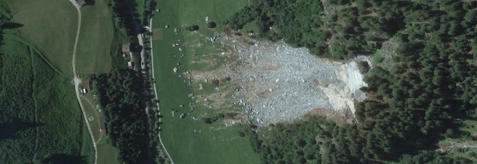
Climate change is significantly modifying precipitation patterns and thermal conditions worldwide. Climatic conditions are changing particularly fast in many high-mountain regions around the globe. In the Alps, temperature has increased twice as much (+2 °C) as the global mean (+1 °C) over the last 150 years alone. An additional warming of several degrees Celsius is expected until 2100.
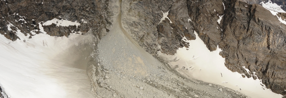
Current climate change causes increased liquid precipitation, a growing number of heavy rain events, increasingly stationary weather conditions (e.g. constant rain) and high-alpine permafrost thaw. As a result, potentially hazardous mass movements such as rockfalls and rockslides are projected to rise in magnitude and frequency. Combined with the increasing human use of the Alpine region, these natural hazards represent a considerable risk factor that is expected grow for the foreseeable future.
Large mass movements are often preceded by deformation in the millimeter range. Small-scale precursory deformation is extremely hard to identify and thus can only be studied at known, active slope failures. Monitoring- and early-warning-systems are therefore mostly restricted to well-known hazard spots and local scale coverage (< 1 km²).
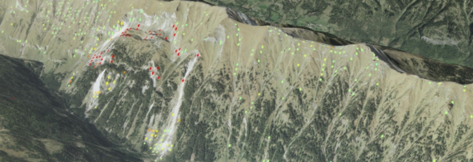
In the ARGE ALP project “Satellite-based detection and monitoring of high alpine mass movements with InSAR” we are performing extensive InSAR analyses (Interferometric Synthetic Aperture Radar) to identify currently unknown, slow rock slope failures in the Eastern Alps. Currently, InSAR represents the only method which allows precise, direct and large-scale detection of ground movement over long times periods.
The project is thematically in line with previous ARGE ALP projects “Fels- und Bergstürze in Permafrost Gebieten“ and “Der Einfluss von Gletscher-Randklüften auf Felsstürze“ and thus focuses particularly on high-alpine permafrost regions. In this particular context the project will investigate if identified small-scale ground movement can be used as proxy to characterize high-alpine permafrost.
SELECTED REFERENCES
Krautblatter, M., Weber, S., Dietze, M., Keuschnig, M., Stockinger, G., Brückner, L., Beutel, J., Figl, T., Trepmann, C., Hofmann, R., Rau, M., Pfluger, F., Barbosa Mejia, L., and Siegert, F. (2024): The 2023 Fluchthorn massive permafrost rock slope failure analysed, EGU General Assembly 2024, Vienna, Austria, 14–19 Apr 2024, EGU24-20989, https://doi.org/10.5194/egusphere-egu24-20989, 2024.
Otto, J.-C., Schroeckh, T. R., and Keuschnig, M. (2024): Assessing rock glacier activity in the Austrian Alps using radar interferometry and image correlation techniques, EGU General Assembly 2024, Vienna, Austria, 14–19 Apr 2024, EGU24-13150, https://doi.org/10.5194/egusphere-egu24-13150, 2024.
Gerstner, R., Frießenbichler, M., Avian, M., Maschler, A., Fey, C., Valentin, G., Keuschnig, M., Mair, V., Goldschmidt, F., and Zangerl, C. (2024): High-alpine rock slides controlled by pre-existing geological structures and brittle rock mass fracturing, EGU General Assembly 2024, Vienna, Austria, 14–19 Apr 2024, EGU24-1670, https://doi.org/10.5194/egusphere-egu24-1670, 2024.
Gerstner, R., Severin, S., Valentin, G., Keuschnig, M., Goldschmidt, F., Zangerl, C. (2023): Internal deformation of an active, deep-seated, multi-slab rock slide and its control on secondary rock fall processes - case and numerical modelling study of the Wasserradkopf rock slide, 6th World Landslide Forum, Nov 14-17, Florence, Italy, 2023.
Keuschnig M., Markus D., Hartmeyer I. (2022): Satellite-based detection of ground motion for monitoring torrent catchments and protective structures. Journal of Torrent, Avalanche, Landslide and Rock Fall Engineering, 86. Jahrgang, Heft Nr. 190, 78 - 86, ISBN: 978-3-9504924-4-6.
Official project website: https://www.argealp.org/de/projekte/d/satelliten-basierte-detektion-und-ueberwachung-von-hochalpinen-massenbewegungen-mit-insar


