PROJECT Kyrgyz_LMEWS
Scale-based monitoring and early warning system for uranium legacy complexes in Kyrgyzstan.
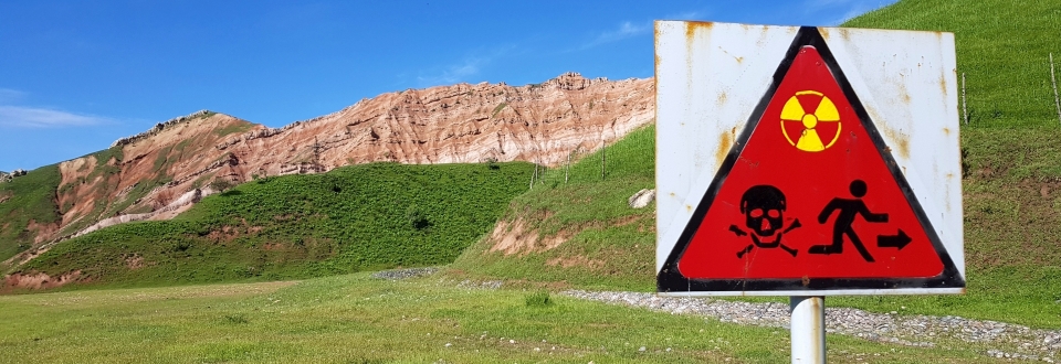
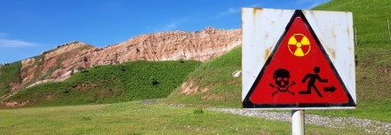
Radioactive waste and the legacies of uranium mining combined with massive landslides pose tremendous risks to vast areas of Kyrgyzstan and their inhabitants. For risk reduction and based on cutting-edge technologies, GEORESEARCH is developing a spatial and temporal scalable monitoring and warning system for landslides.
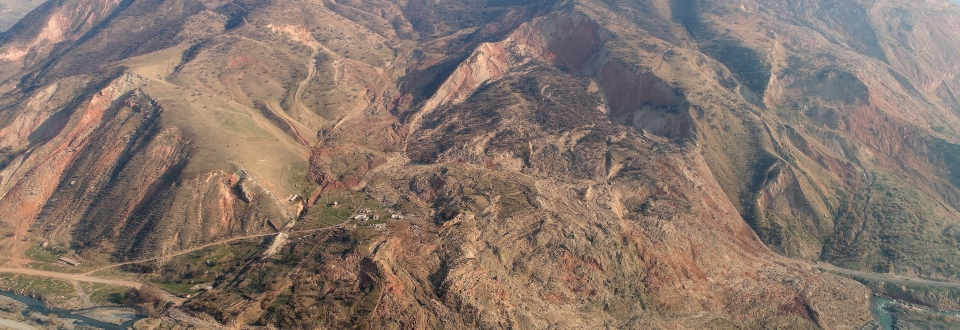
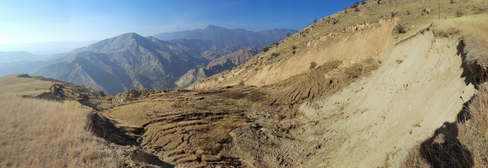
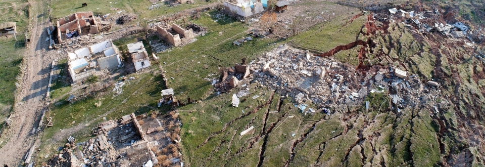
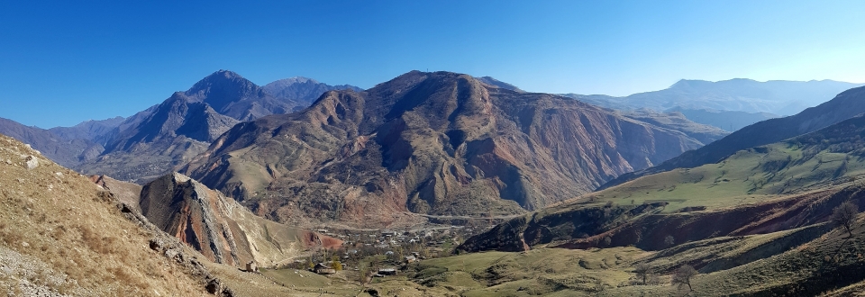
Vast areas of Kyrgyzstan are characterised by the high-alpine landscape of the Tianshan mountain range: 70% of the country’s territory is situated at more than 3.000 m above sea-level and the highest peak, Pik Pobeda, reaches 7.439 m into the sky. Due to the prevalent extreme high-alpine character (relief, climatic conditions) and intensive seismic activity (earthquakes), Kyrgyzstan is especially prone to natural hazards such as landslides, avalanches and flooding. Especially the South of the country is a particular “hotspot” for major gravitational mass movements: extensive slides can reach several tens of meters in heights. In course of heavy rainfalls or earthquakes, the loose fine material is easily mobilized, frequently resulting in enormous hang slides, mudslides and debris flows.
Apart from the already mentioned natural hazards common in the area, Mailuu Suu, a former soviet mining town in southern Kyrgyzstan, furthermore faces risks posed by unstable uraniumtailings pits on the tectonically unstable hillside above the town. Resulting risks comprise the potential destruction of these tailings and thus, the mobilisation of radioactive materials through streams and rivers into intensively cultivated agricultural areas. The project’s long-term aim is to increase the safety of Kyrgyz uranium legacy complex sites through optimised monitoring and remediation measures.
The project’s long-term goal is to improve the safety in and around Kyrgyz uranium legacy sites through optimized monitoring and remediation measures. Among others, the following research questions are addressed: (1) Which types of mass movements occur and what are the resulting hazards and risks? (2) Given the present situation, which technologies and methods are best-suited for monitoring and early-warning?
The development of the monitoring and warning system for landslides is part of the EU-funded project "Conducting an integrated Environmental Impact Assessment and Feasibility Study for the Safe Management and Remediation of the Uranium Legacy Complex of Mailuu Suu, Kyrgyzstan (EuropeAid/138036/DH/SER/KG; 2017 – 2019)". GEORESEARCH is member of an international consortium under the lead of WISUTEC Umwelttechnik GmbH.
PROFILE
Contribution GEORESEARCH: Landslide Experts in WP 2 - Design, Technical Specifications and supervision of installation of mobile and fixed equipment for risk assessments at legacy sites in the Kyrgyz Republic
Project Partners: Wisutec Umwelttechnik GmbH, Wismut GmbH, Facilia AB, Geoconsult ZT GmbH, Belgian Nuclear Research Center (SCK CEN)
Project Duration: 2017 - 2021
Funding: European Commission (EuropeAid/138036/DH/SER/KG; 2017 – 2019)
PROJECT PARTNERS
Wisutec Umwelttechnik GmbH
Belgian Nuclear Research Center (SCK CEN)
MEDIA Radioactive Waste in Kyrgyzstan

Radioactive waste and the legacies of uranium mining combined with massive landslides pose tremendous risks to vast areas of Kyrgyzstan and their inhabitants. Funded by EuropeAid, we developed a new landslide early warning system in direct collaboration with our partners - a recent ORF news article on our project is available here (only in German).
more details ...
SELECTED REFERENCES
Keuschnig M., Schober A., Delleske R., Brandner K., Höfer-Öllinger G. (2021): Scale-oriented landslide monitoring and early warning system for uranium legacy complexes in Mailuu Suu, Kyrgyzstan. Geomechanics and Tunneling 14(1): 47-53, DOI:10.1002/geot.202000048.
Salzburgs Lösung für Kirgistans Atommüll (2020): ORF1 - Hallo Österreich, 10.11.2020.
Atommüll in Kirgistan: Salzburger entwickeln Warnsystem (2020): ORF Salzburg, 26.10.2020: https://salzburg.orf.at/stories/3073138/.
Keuschnig M., Schober A., Delleske R., Höfer-Öllinger G., Brandner K. (2018): Entwicklung eines skalenbasierten Überwachungs- und Frühwarnsystem von Hangrutschungen für radioaktive Altlasteneinfrichtungen in Kirgistan. Article and presentation at Geoforum Umhausen.