InSAR COMPETENCE CENTER
Measuring ground motion from space
The ground is moving more often than you would expect. Cutting-edge satellites systematically measure ground movements directly, covering a wide area with high precision in millimeter-range. The information obtained is particularly important for monitoring infrastructures and buildings as well as for detecting natural hazards such as landslides.
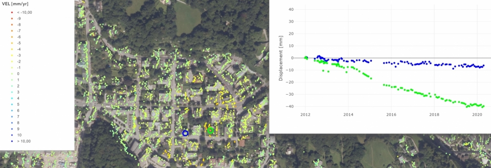
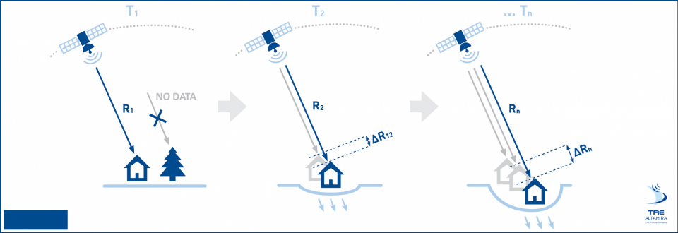
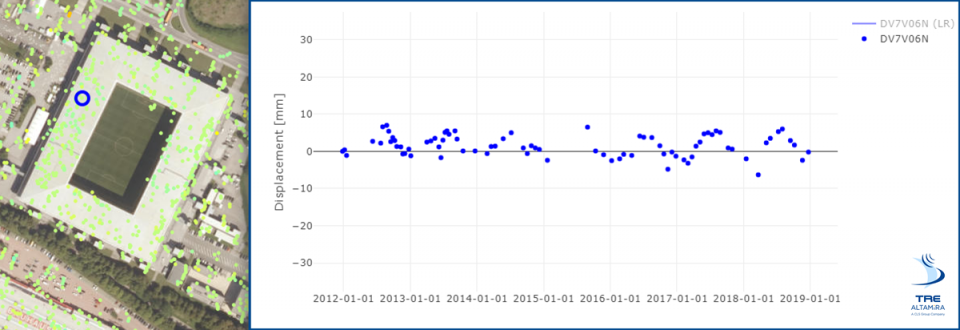
Satellite-based (SB) InSAR (Interferometric Synthetic Aperture Radar) is currently the only method to detect ground motion and deformation (i) precisely and directly (mm accuracy), (ii) in a scalable way (from single building to vast areas) and (iii) over long periods of time (from less than one up to 25 years, historical archives). SB-InSAR is a proven technology, the first ERS-1 radar satellite was commissioned by the European Space Agency (ESA) back in 1992. Limiting factors then included the low resolution (30 * 30 m) and the long return time of 35 days (reattainment of the starting point). When the German Earth observation satellite TerraSAR-X was put into operation in 2008 it already achieved a resolution of 1 * 1 m and a return period of 11 days. This made it particularly suitable for engineering issues. Due to the Copernicus (EU, ESA) Earth Observation programme, data from Sentinel satellites have been available almost worldwide and free of charge since the end of 2014. The Sentinel-1 satellites reach a resolution of 20 * 5 meters (IW mode) and a return time of 6 days. Currently there are just around a dozen In-SAR satellites and the trend is rising sharply.
Together with our partner TRE ALTAMIRA, the world leader in satellite-based detection of ground movements, we founded the InSAR Competence Center. Among numerous other things, TRE ALTAMIRA has developed the industry standard for extracting displacement measurements from satellite data. Our partner has extensive experience and is equipped with the most modern infrastructure for the automatic processing of huge amounts of data.
It is our common goal to develop innovative InSAR applications based on cutting-edge technologies. In order to generate the greatest possible added value, the entire life cycle of infrastructures and structures (from planning to demolition) is considered. In the field of natural hazards, the focus is on alpine spaces. In this environment steep rock faces, changing snow and vegetation conditions make data analysis and interpretation difficult.
Do you have a challenging application case? Do you want to discuss new ideas or develop potential applications with a highly skilled and motivated team? – We already look forward to hearing from you! You can reach us via phone: +43 699 12220044 or email: office@georesearch.ac.at.